Confused
Apamea furva

Species account (old)
Robson noted this as 'A very rare species, and has only occurred on or near the coast'. [...] In Durham there is a good colony on Waldridge Fell where TCD has found it since the 1950's, and which probably provided the occasional specimens taken at Chester-le-Street. This is by no means a limestone area, being a coal measure site. Otherwise I. Findlay takes it in the Forest-in-Teesdale trap at Langdon Beck, R. Woods recorded specimens from Crooks Altar, a site on the moorland crown between Westgate in Weardale and Rookhope, and quite near a limestone quarry, and B. and I. D. Wallace took a specimen at Wolsingham in 1978. This latter [...] [was] checked by genital examination.
Statistics
| Records | 48 |
|---|---|
| Individuals | 61 |
| Largest Sample | 4 |
| First Recorded | 1876 |
| Last Recorded | 2024 |
| Earliest Adult Record | 20/06 |
| Latest Adult Record | 01/10 |
| Monad Coverage | 0.5% |
| Hexad Coverage | 28.6% |

Map
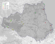
This map shows all records of Confused - Apamea furva in the Durham (VC66) database per monad (1km grid square). The map can be explored further by zooming and panning, can be reset using the button on the left, and can be filtered by selecting the era. Click on a monad to view a full list of species recorded in it, or its containing hexad (10km grid square).

Week graph
This graph shows the County Durham (VC66) records of Confused - Apamea furva per 7-day period, differentiated by life stage. Hover over/tap the graph to see an exact count of records at that point in time. Hover over/hold the life stage legend to highlight a particular life stage; click on a life stage label to remove it from the graph. The graph can be filtered further by selecting the era.
The graphs below show the total records and individuals of Confused - Apamea furva in County Durham (VC66) per time period. Hover over/tap the graph to see an exact number of records and individuals at a particular point in time. Hover over/hold a label to highlight a particular metric; click on a metric label to remove it from the graph.
Era graph
Year graph

Gallery
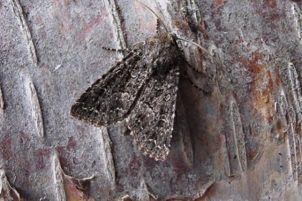
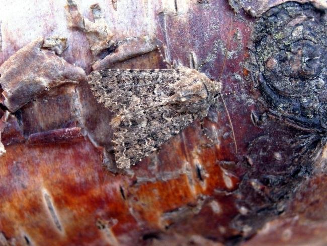
This gallery shows images of Confused - Apamea furva. Clicking on a photo opens it in a large lightbox with a full caption, and the arrow buttons move between photos. If you would like to contribute any photographs, particularly of any stages not captured here, please email admin@durhammoths.org. Most photos on this website have been taken by County Durham (VC66) recorders, but please note that not all have been taken in the county.

Foodplants
This is a list of foodplants known to be used by the larval stages of Confused - Apamea furva in the UK.
Habitats
This is a list of habitats that Confused - Apamea furva is known to occur in within the UK.
Habitat and foodplant information derived from Cook, P.M.; Tordoff, G.M.; Davis, A.M.; Parsons, M.S.; Dennis, E.B.; Fox, R.; Botham, M.S.; Bourn, N.A.D. (2022). Traits data for the butterflies and macro-moths of Great Britain and Ireland, 2022. NERC EDS Environmental Information Data Centre. https://doi.org/10.5285/33a66d6a-dd9b-4a19-9026-cf1ffb969cdb


